Overview
The MapEO is a data processing service that converts optical aerial drone data into geo-referenced images. The camera sensors attached to drones collect RAW radiance and irradiance data together with GPS/IMU information. This information is then converted into geo-referenced water-leaving reflectance products, which provide information on parameters such as turbidity, total suspended sediments or chlorophyll concentrations.
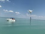
Using drones as a tool to monitor water quality is especially useful as they can be deployed in all but the worst weather conditions, flying just tens of metres above the water surface, to look at centimeter scale features. In just one flight a single drone can cover several thousands of square metres!
Drone data products can help to fill the gaps in traditional water sampling and satellite remote sensing, as they have a high spatial resolution, are not hindered by cloud cover and can provide multiple surveys per day. Drones also allow collection of data in hard to reach areas.
Through MONOCLE the MapEO service has operationalized the processing workflow in the cloud and developed the processing of multispectral data along side RGB data.

The camera measures radiance over water bodies, expressed in Digital Numbers (DN).
MapEO Water converts these into physically meaningful values:
- Water leaving reflectance
- Turbidity
- Total Suspended Matter
- Chlorophyll-a concentrations
In the development of the MapEO services some key challenges in application of image technology to characterize water columns had to be overcome, for example:
- Water bodies often look dark on images.
- The interaction of the light with the atmosphere just above the water surface plays a major role (sky glint). Luckily, this can be modelled through a modified version of VITO’s atmospheric correction algorithm iCOR (iCOR4Drones).
- The water surface acts as a mirror (sun glint). Therefore, a well-adapted flight protocol and hardware setup is indispensable.
- The water column is often a dynamic environment, variations in currents and tides can lead to a rapidly changing scene under investigation.
These challenges are addressed one by one in a clear processing workflow.
Diagram of MapEO workflow

Technical drawing
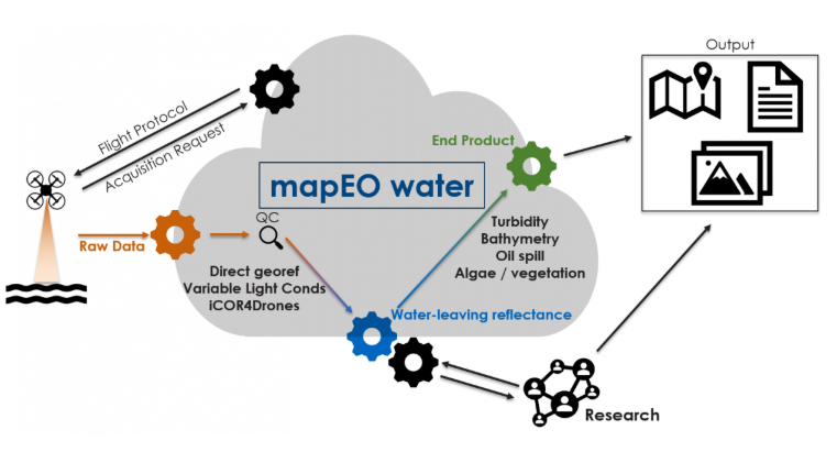
Graphical image of the processing workflow that makes up the MapEO water service.
The system has to collect data according to predefined flight instructions to avoid contamination by sun glint, and enable correction for incoming irradiance.
We provide several interoperable data interfaces, as detailed below:
Type of data: Drone imagery collected by/for MONOCLE
Format: WMS, WCS (processed imagery)
Front-end
WMS GetCapabilities
WCS GetCapabilities
Supporting materials
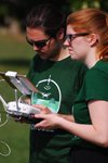
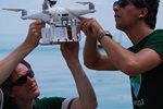
User guide: Drone data acquisition over water bodies with DJI Phantom 4 pro
User guide: RPAS: Remotely Piloted Aircraft Systems - Deployment and Operation
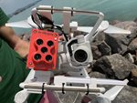
User guide: Micasense RedEdge-M integrated under DJI Phantom 4 pro
User guide: Drone data upload tool - Field Software
Video: Introduction to MapEO Water workflow process
Webinar: Monitoring water quality with satellites and drones
Webinar: Airborne drone-based monitoring of surface water quality
Download the operational protocols for MONOCLE sensors and platforms
This document provides a set of protocols for
the deployment of MONOCLE systems to ensure best practices to collect reliable data.
System user and developer handbook This handbook provides an overview of the data requirements and interfaces that were adopted in the sensors and observation platforms of MONOCLE.
VITO Remote Sensing Mapeo-Water website
Examples of sensor use
Drones and dredging! Is there a match?
How to integrate a multispectral camera under a low-cost drone
Mapping Water Quality with Drones: Test case in Texel